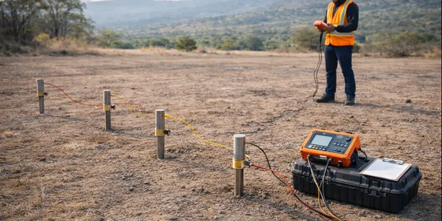
In London, geophysics addresses the complex ground conditions shaped by the London Basin’s variable strata, including Thames alluvium, river terrace gravels, and the underlying London Clay. Near-surface investigations must align with British Standards such as BS 5930 and Eurocode 7, particularly where buried obstructions or paleochannels influence foundation design. We routinely apply shear-wave velocity (MASW/VS30) profiling to derive site classification per BS EN 1998-1 for seismic hazard assessment, and electrical resistivity / VES to map clay thickness and groundwater interfaces critical to basement and tunnelling projects.
Typical commissions span deep basements, infrastructure cuttings, and flood defence works where rapid, non-intrusive data is essential. Resistivity imaging also supports UXO risk mitigation in brownfield sites, while shear-wave data informs soil-structure interaction models required by Transport for London and Network Rail. For integrated ground models, these techniques pair directly with our MASW / VS30 surveys and resistivity profiling, ensuring compliance with local planning conditions tied to ground movement and settlement risk across Greater London.
Geophysics in London provides a non-intrusive means of mapping subsurface conditions before any physical ground investigation begins, helping to identify buried structures, voids, and geological hazards across the capital’s complex terrain. London’s geology is famously varied, with River Terrace Deposits overlying London Clay, Lambeth Group sands, and the chalk aquifer at depth, all of which can be profiled effectively using techniques like electrical resistivity tomography and ground penetrating radar. These surveys are guided by BS 5930:2015+A1:2020, the UK code of practice for ground investigations, ensuring data is collected to a standard suitable for design. Early-stage geophysics often directs the placement of follow-up ground investigation boreholes or exploratory test pits, reducing overall project risk and expenditure.
Methodology follows a phased approach aligned with BS 5930 and the recommendations of CIRIA C812, beginning with a desk study to define targets, then deploying the most appropriate geophysical arrays for the specific lithology and depth of interest. In London, seismic refraction and MASW (multichannel analysis of surface waves) are routinely used to determine rippability and small-strain stiffness, while magnetic and electromagnetic profiling detects ferrous obstructions in brownfield sites. Data acquisition parameters are calibrated against physical ground-truthing, typically from Cone Penetration Testing (CPT) or Standard Penetration Testing (SPT), to convert geophysical anomalies into geotechnical properties. This integration with direct testing ensures compliance with Eurocode 7 requirements for deriving characteristic ground values.
Typical London projects span basement impact assessments in conservation areas like Westminster and Kensington, where minimal disturbance is paramount, to major infrastructure works such as the Thames Tideway Tunnel and Crossrail, where geophysics mapped fault zones and solution features in the chalk at tunnel depth. Utility detection surveys are standard on congested urban sites, while cross-hole seismic tomography supports deep foundation design in the City’s high-rise cluster. For shallow works, In-Situ such as the flat dilatometer or pressuremeter test is often combined with geophysical profiles to build a continuous ground model between discrete test locations, improving confidence in the interpreted stratigraphy.
The process delivers a layered interpretation in plan and section, typically as a CAD or GIS deliverable with a factual report citing all acquisition parameters and processing steps. Clients receive a clear picture of bedrock depth, groundwater pathways, and anomalous zones that may require targeted intrusive investigation. By integrating geophysics early, London developers and engineers reduce the number of boreholes needed, avoid unforeseen ground conditions, and de-risk foundation and basement construction in one of the world’s most geologically intricate cities.